Blogroll
Our old hiking page14ers.com
Gerry Roach
SummitPost
Colorado Trail Foundation
Continental Divide Trail Coalition
Pacific Crest Trail Association
Appalachian Trail Conservancy
Appalachian Trail Blog

Starting from Lefthand Canyon Dr, we parked above Buckingham Park off of Lefthand Canyon Dr where it crosses over Lefthand Creek. The elevation at the parking place was 6073 feet. The eventual high point was Fairview Peak where our GPS gave an elevation of 8592 feet. So the elevation difference from low to high was 8592-6073 = 2519 feet, not counting a significant plunge into Spruce Gulch from the forest trail 286 overlook.

This hike formed a loop in a counterclockwise direction, as you can see from the GPS tracks. The GPS didn’t start tracking until the overlook above Spruce Gulch just before we plunged down into the gulch. The missing part of the GPS tracks was a continuous trail almost directly across from where we parked to the overlook, which is forest trail 286-1.

From Spruce Gulch we ascended the east ridge of Fairview Peak, which started with easy meadow walking but got more rough, rocky, and brambly as we continued up. Following the ridge, we clambered to the top of rugged knob 7880, and continued along the ridge until we finally got onto an old 4WD road on the north side of the ridge which took us in the direction of the Fairview Peak summit. We reached the summit at a time of about 3 hours from the start of the hike. As the name suggests, the views from the Fairview summit are really nice.

For our return trip, we continued on the 4WD road that we came in on, heading southwest until its intersection with forest rd 87J, then took 87J east. Note that heading east on 87J we came across numerous “No trespassing” or “Private property” signs that were pointed the other way. We also came to a gate with same signs, and then another one, and continued on forest trails 288 and 286 back to Lefthand Canyon. The total time for the hike was about 5 hours.

Our video of the hike
A hike to Balanced Rock in Rocky Mountain National Park on Nov 17, 2023. The distance is 3.8 miles one way, with an elevation change from lowest (trailhead, 7840ft)) to highest (Balanced Rock, 8880ft) of a little over 1000 feet (305 meters). We’ve done this hike many times. We love the terrain and the solitude, having never met anyone at Balanced Rock before.
Our GPS tracks (a little messed up due to tracking problems)
We did this loop 2 years ago, so knew what we were getting into. The south side of the reservoir, until reaching North St Vrain Creek, is mostly without human made trails, so we figured we’d tackle this most challenging part first. The forest and terrain of the south side also makes it easy to lose one’s way, so before attempting the loop, we entered 3 waypoints into our GPS:
- 7000 line: 40.208150,-105.374212
- Saddle pt: 40.210050,-105.384554
- N St Vrain Creek: 40.212463,-105.392730
These waypoints are marked with blue markers on the map of our GPS tracks. The first waypoint showed us how far we needed to climb the first ridge following the first cove, which is at an elevation of 7000 ft (2134 m). The second waypoint is a point on the next ridge that is at about the same elevation as the first point. Our plan was to stay at about 7000 ft from the first to the second ridge. The third waypoint was roughly where we planned to cross North St Vrain Creek.

Starting at the Button Rock Preserve Trailhead, we headed up Longmont Dam Road to the bottom of the dam. Taking the trail to the top of the dam, we walked across the dam to its south side. From the end of the dam to the first cove, there is a nice shoreline trail, which we used.

A little after the first cove, we left the trail and headed up the ridge toward our first waypoint. From there, we came across game trails which we used to our advantage when they went in the desired direction. As planned, from the first to second waypoints, we stayed at about 7000 ft. After passing by the south side of the second waypoint we set our direction toward the third waypoint at the creek. This part was all downhill to the creek.

Getting to the bank of the creek can be tricky, as the side of the creek has frequent bluffs. At first, we were unable to reach the creek, and so walked upstream above the bluffs until finding an access point. Our actual crossing point (40.21071,-105.39359, elevation 6552ft) is marked in orange on the map.

Once at the bank, we switched from boots to sandals, which had been stowed in our backpacks, and carried our boots across the creek. Being the time of year with the lowest water level, it was easy to cross, but the water was mighty cold.

After drying off our feet and putting our boots back on, we headed downstream and upward in elevation until reaching a dirt road, which we followed until the west end of the reservoir, where a shoreline trail begins around the reservoir’s north side.

This trip took about 6 and 1/2 hours, with stops for removing and putting on boots, as well as lunch on the north shore, and frequent stops for photography and taking it all in. Total distance traveled was about 9 miles. Elevation difference from lowest (6000 ft) to highest (7100 ft) was about 1100 feet, with lots of ups and downs.

Our video of Button Rock Dam and Ralph Price Reservoir

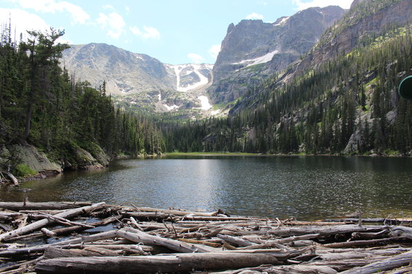
Parking at the Fern Lake Trailhead we hiked to Fern Lake, then Odessa Lake.

The first part of the hike from the trailhead to Fern Lake was a very different experience than I expected, due to the East Troublesome Fire that burned this area in 2020. The trees left standing are black, and the wildflowers have taken over, especially fireweed (Chamerion danielsii).

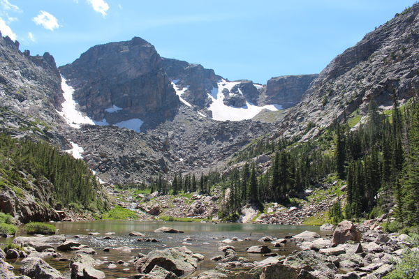
We started our trek up to Tourmaline Lake from the west side of Odessa Lake. There is no trail up to Tourmaline Lake. There are occassional patches of trail and/or cairns, but nothing coherent to get you there. The last time we did this climb was 11 years ago, and our memory had faded.
The route we took up is the northernmost one shown on the GPS tracks. This way was very rugged, and once we reached Tourmaline Lake, we were not inclined to return the same way. The return route was significantly easier, and is the southernmost route on the GPS tracks.
If we would do it again soon, we would basically ascend by our return route, beginning the ascent from Odessa Lake before reaching the Tourmaline Lake outlet where it spills into Odessa Lake, then ascend straight up (northwest) for awhile until getting above a band of cliffs overlooking Odessa Lake. Then we’d go southwest for awhile, above the cliff bands, and finally in a general northwest direction to Tourmaline Lake.
Tourmaline Lake is pristine and beautiful, with no signs of humanity. We saw no person at Tourmaline Lake, or on the way up or down between Tourmaline and Odessa.
The total distance was about 10 miles (5 miles one way), with an elevation gain from the Fern Lake Trailhead (8165 ft, 2489 m) to Tourmaline Lake (10580 ft, 3225 m) of 2415 ft (736 m).
© 2012-2023 Stefan Hollos and Richard Hollos