Bueno Mountain (8,662 ft) from Jamestown, 03/08/2009

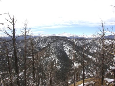
Bueno Mountain and Indian Peaks from Porphyry Mtn summit, 02/16/08

Elevation versus distance, 03/08/09
Bueno Mountain is a Boulder County peak, northwest of Jamestown, at the top of Moorhead Gulch. It's southwest of Porphyry Mountain, north of Walker Mountain, and east of Overland Mountain. Bueno Mountain is an unranked Roach.
You can see the GPS tracks for this entire hike.
We started hiking at 11:03, from Elyseum Park in Jamestown. Turning left after the post office, we hiked down Boulder County Rd 102J (Ward St), which follows James Creek, and is blocked off a few tenths of a mile from its start. At 11:51, with the odometer at 2.22 miles, we departed from the road, turning right and ascending the south ridge of Bueno Mountain. The terrain was reasonable all the way to the summit, with lightly wooded forest.
Reaching the Bueno Mtn summit at 12:57, our odometer showed 3.5 miles. The views from the summit are not very nice, being surrounded by conifers, but Mt Meeker and Longs Peak can be seen through the trees. The large summit cairn that we had built up in 2004 was flattened. We stacked a couple rocks to take its place. There was no summit register.
From the Bueno summit, we headed west to the Bueno-Overland saddle, and then toward Overland Mountain. We soon came upon a barbed wire fence and a "no trespassing" sign blocking our way to Overland. Since we had done Overland Mtn in 2007, we decided not to pursure it, and headed down the south ridge of Overland toward CR102J, stopping for lunch along the way.
We returned to our parking place at 15:24, with the odometer at 8.28 miles. The elevation gain from lowest (parking) to highest (summit) was 1,748 feet, and the total trip time was 4 hrs, 21 minutes.
- Richard Hollos and Stefan Hollos
| Place name | Elev [ft] | Accuracy [ft] | Lat/Lon |
|---|---|---|---|
| Parking at Jamestown (Elyseum Park) | 6962 | 14 | 40.11575,-105.38816 |
| Bueno Mountain summit | 8710 | 7 | 40.12257,-105.41408 |