Button Rock Preserve/Hall Ranch Loop, 05/16/2011
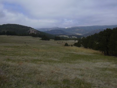
Looking west from Button Rock Trail, 05-16-11
You can see the GPS tracks for this hike.
Starting from the Button Rock Preserve parking area, we headed west along the gravel road for about 1/2 mile, then turned left onto an unofficial trail to the Lions Den climbing area.
We then headed southwest to a ridge, crossing over it, then southeast to the Button Rock Trail on the western side of Hall Ranch. Then we turned west along the Button Rock Trail across beautiful open meadow country.
Continuing west, we eventually reached the Sleepy Lion Trail which we took down to the outlet of the dam of Ralph Price Reservoir. From the outlet, we followed the trail to the top of the dam, then enjoyed a lunch on the shore of Ralph Price Reservoir.
Continuing northwest, we walked along the shore until reaching the spillway. Turning east, we followed the road which parallels the spillway to its intersection with the Longmont Dam Road. We returned to our parking place via the Dam Road.
One of the things we like about Button Rock Preserve are the large variety of birds. This time we weren't disappointed. We saw a Great Blue Heron at Longmont Reservoir, a couple American Dippers in the North St Vrain, and a Western Meadowlark at Hall Ranch.
The GPS odometer showed a roundtrip distance of 6.5 miles, and the time was a little over 4 hours.
- Richard Hollos and Stefan Hollos
| Place name | Elev [ft] | Accuracy [ft] | Lat/Lon |
|---|---|---|---|
| Parking at Button Rock Preserve | 6018 | 20 | 40.22864,-105.34176 |
| Reached Button Rock Trail | 6720 | 13 | 40.21898,-105.33353 |