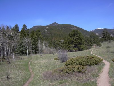
Dark Mountain (10,859 ft) from Cow Creek Trailhead, 05/17/2009

Dark Mtn from Cow Creek-Black Canyon Trail intersection, 05-17-09

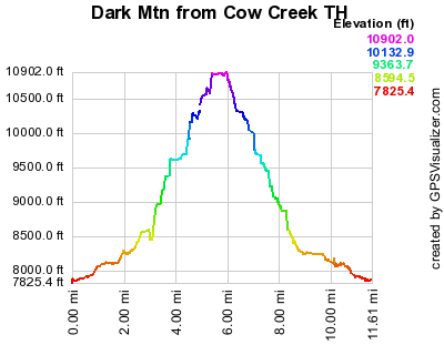
Elevation versus distance, 05/17/09
Dark Mountain (10,859 ft) is a Larimer County Peak near Estes Park. It's north of MacGregor Mountain and east of Bighorn Mountain.
You can see the GPS tracks for this entire hike.
From the Cow Creek Trailhead, we started hiking at 9:20. Heading east on the Cow Creek Trail, we hiked 2.2 miles to where the trail splits. To the right, the Cow Creek Trail goes to Bridal Veil Falls, and to the left is the Black Canyon Trail. We took the Black Canyon Trail for about 0.2 miles, then turned right, leaving the trail and ascending the east ridge of Dark Mountain.
Passing by Point 9609 on the ridge, we continued east, and reached the summit of Dark Mountain at 11:40, with the odometer at 5.43 miles. It took 2 hrs, 20 minutes to reach the summit.
The view from the summit is spectacular. MacGregor Mtn, Ypsilon Mtn, Mummy Mtn, The Needles, Fairchild Mtn, Bighorn Mtn, Mt Dickinson, and Signal Mountain were all visible.
We found a summit register placed there in 1992, and it was only about half full. There were only three days this year with signings. The previous day there were two people on the summit.
We returned approximately the way we came, getting back to our parking place at 15:17, with the odometer at 11.1 miles. The elevation difference from lowest to highest was 3,029 feet.
- Richard Hollos and Stefan Hollos
| Place name | Elev [ft] | Accuracy [ft] | Lat/Lon |
|---|---|---|---|
| Parking near Cow Creek | 7879 | 11 | 40.42999,-105.50076 |
| Low spot on hike (Cow Creek) | 7852 | 9 | 40.43109,-105.50066 |
| Dark Mountain summit | 10881 | 7 | 40.43237,-105.57198 |