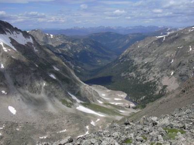
Lion Lakes Pass (12,600 ft), 07/25/2009

North Inlet from Lion Lakes Pass, 07-25-09
From the Wild Basin Ranger Station, we started hiking at 7:20, heading up the main trail, then the Thunder Lake Trail, then the Lion Lakes Trail. After Snowbank Lake, we ascended the ridge heading northwest to the pass, which we reached at 11:15, with the odometer at 8.42 miles.
This pass is the saddle between Mt Alice and Chiefs Head. There are spectacular views of the sides of these two mountains, as well as McHenrys Peak, Stone Man Pass, and the North Inlet on the other side of the Divide.
From this pass, it looked enticing to head up Chiefs Head, then make a loop of it by heading down the Orton Ridge, but the forecast for the day convinced us to return the way we came.
We returned at 15:55, for a total trip time of 8 hrs, 32 minutes, and distance of about 17 miles. The elevation gain was 4,076 feet.
- Richard Hollos and Stefan Hollos
| Place name | Elev [ft] | Accuracy [ft] | Lat/Lon |
|---|---|---|---|
| Parking at Wild Basin Ranger Stations | 8524 | 12 | 40.20800,-105.56628 |
| Lion Lakes Pass | 12600 | 9 | 40.24541,-105.66064 |