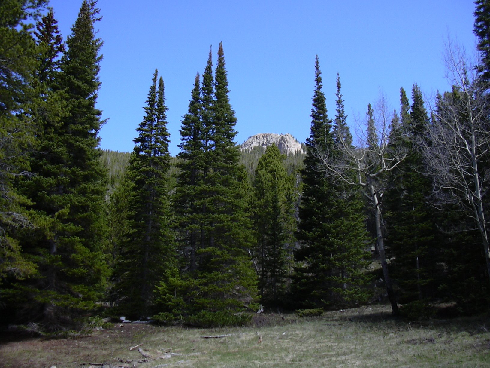
Point 10,583 (Roach #36) from Peaceful Valley, 05/31/2008
Knob of Point 10583, 05/31/08
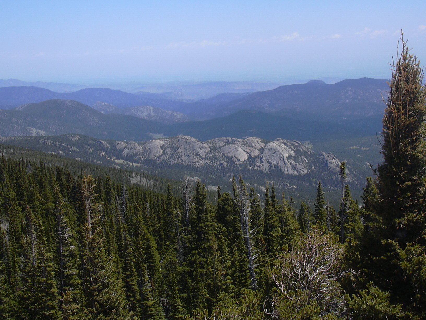
The Ironclads from summit of Point 10583, 05/31/08
Point 10583 (10,583 ft) is ranked number 36 in Gerry Roach's Summits of Colorado's Boulder County list.
You can see the GPS tracks for this entire hike. There are some gaps, due to the GPS not tracking.
We parked at Peaceful Valley just before Bunce School Road at an elevation of 8623 feet.
Beginning our hike at 10:10, we headed north on Bunce school road. Eventually turning left off Bunce School Road, then following a series of forest roads and trails, we headed north, then west, then northwest, and gained the southwest ridge of Point 10583. The road/trail eventually disappeared before gaining the ridge.
Hiking along the southwest ridge to the summit turned out to be very slow going, due to the large amounts of snow still remaining. If I had to do it again, I would have ascended the way we eventually descended the mountain, which is also shorter distance-wise.
We reached the summit at 12:37, with the odometer showing 3.54 miles. There is a USGS marker on the summit, but no elevation written on it. There is a small limber pine on the summit, but the views are outstanding. It has the best view of the Ironclads I've ever seen. Other prominent views are Saint Vrain Mtn, Meadow Mtn, Mt Meeker, Longs Peak, Mt Audubon, and Point 10810.
The summit register was place by Mike Garratt on Nov 29, 1997. I saw Luke Plumely and Buster's entry on June 12, 2004. The last entry was Nov 11, 2007 by John Prater and two others. We were the first to sign it this year. There were only three unique dates in the register since we first signed it on May 13, 2006.
The little register notebook has been there for 11 years. It has 60 sheets of paper in it, and 10 sheets have been consumed. So at that rate, the notebook should last another 55 years before it fills up. I guess we'll come back in 2063 to replace it ;).
We left the summit at 13:07, heading south. About 200 feet below the summit, we came upon an overook, with a precipitous drop on its southwest side, which provided a great view of Beaver Reservoir. Continuing south we eventually intersected an old forest road that we had hiked in on. From there, we returned the way we came.
Getting back to our parking place at 15:54, the odometer showed 7.93 miles. The actual distance is probably about 9 miles, since the GPS tracking was patchy. The elevation difference from lowest (parking) to highest (summit) was 2,008 feet. The total trip time was 5 hrs, 33 mins, which included a 1/2 hour stop on the summit, and a lunch later on.
- Richard Hollos and Stefan Hollos
| Place name | Elev [ft] | Accuracy [ft] | Lat/Lon |
|---|---|---|---|
| Parking at Peaceful Valley near Bunch School Rd | 8623 | 16 | 40.13194,-105.50870 |
| Location of very large Limber Pine | 10568 | 34 | 40.15265,-105.52424 |
| Point 10,583 summit | 10631 | 11 | 40.15375,-105.52248 |