Rock Creek Canyon, 11/22/2008

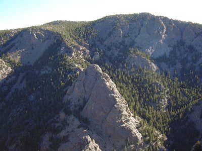
Rock Creek Canyon rim, 11/22/08

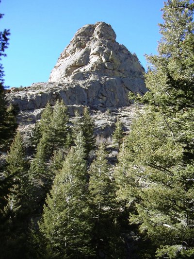
In Rock Creek Canyon, 11/22/08

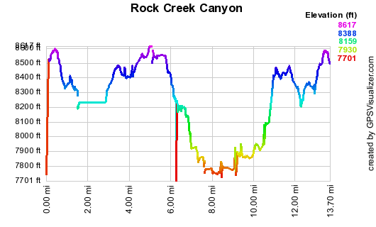
Elevation versus distance, 11/22/08
Rock Creek is a tributary of North St Vrain Creek. Its canyon, like that of North St Vrain Creek, is incredibly scenic, beautiful, and rugged. Hiking through this area, the phrase God's Country might come to mind.
You can see the GPS tracks for this entire hike.
From Lyons, we headed to Allenspark on Hwy 7, and a few hundred feet before the top of the hill at Allenspark, we parked off the side of the highway, where forest service trail #932 begins.
Starting our hike at 9:41, we went east then north on trail 932, over the ridge of Point 8624, then through a maze of other trails, crossed Fox Creek and headed east to the rim of Rock Creek Canyon.
Just before Fox Creek, with the odometer at 1.05 miles, Stefan noticed we were walking over Iron Dike rock.
We hiked north along the west rim of Rock Creek Canyon until reaching the confluence of Rock Creek and North St Vrain Creek, then made a steep descent down to Rock Creek. We reached Rock Creek at 12:20, with the odometer at 6.64 miles.
At Rock Creek, we headed south, going upstream, until just before Fox Creek flows into it, at which point, we ascended to the canyon rim to meet our incoming tracks. We then returned along our approach path.
Both the hike along the canyon rim, and the hike along the creek were scenic to the extreme. There is a trail along much of the canyon rim, but only a sporadic coyote trail down along the creek, with thick brush much of the way, making the going slow.
We returned to our parking place at 15:06, with the odometer at 14.4 miles. The total trip time was 5 hrs, 25 minutes. The total elevation gain was roughly 1,800 feet.
- Richard Hollos and Stefan Hollos
| Place name | Elev [ft] | Accuracy [ft] | Lat/Lon |
|---|---|---|---|
| Parking before Allenspark off Hwy 7 | 8513 | 11 | 40.19588,-105.52483 |
| Iron Dike point | 8386 | 26 | 40.20392,-105.51720 |
| Low point at Rock Creek | 7752 | 30 | 40.21312,-105.48985 |