North Signal Mountain (11,262 ft) and South Signal Mountain (11,248 ft), 07/19/2008
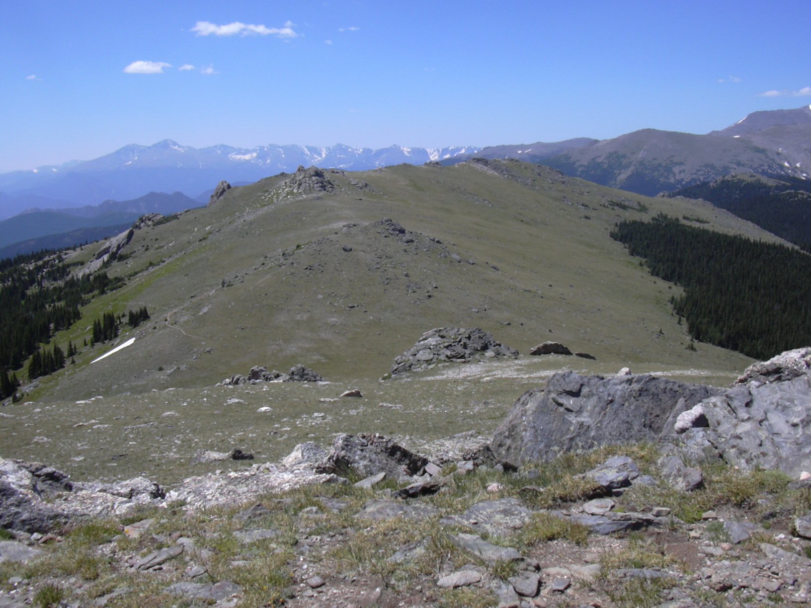
South Signal Mtn from North Signal Mtn, 07/19/08
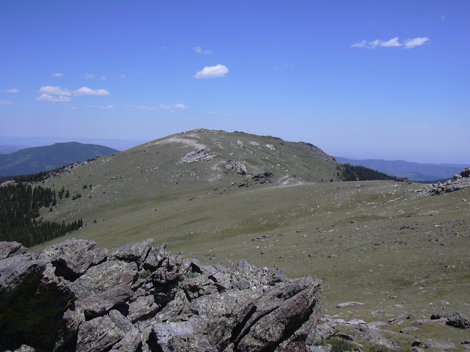
North Signal Mtn from South Signal Mtn, 07/19/08
The Signal mountains are in Larimer County, near the northeast corner of Rocky Mountain National Park. At about 11,250 ft, they are just above treeline. With a nearly 4,000 ft elevation gain and about 6 miles one way from the Northfork Trailhead, it's a great workout.
You can see the GPS tracks for this entire hike. There are some gaps, due to the GPS not tracking.
From Estes Park we drove northeast down Devils Gulch Road and continued to the small town of Glen Haven. About 1.5 miles past Glen Haven, we turned left onto CR-51B at the sign for the Cheley Boys Camp. About 2 miles down this gravel road, we parked at the Northfork Trailhead, which has a spacious parking area.
From the parking area, we started hiking at 9:01, going 1/2 mile up the dirt road to the Bulwark Ridge Trailhead, and turned right onto the Bulwark Ridge Trail. This trail ascends Bulwark Ridge to its end, and from there it's less than a mile to South Signal Mtn, then another 0.6 miles to North Signal.
We reached the intersection of the Bulwark Ridge Trail (No 928) and Indian Trail (No 927) at 9:37, where the odometer showed 1.48 miles.
We continued on the Bulwark Ridge Trail to the top of the ridge. This entire way is forest. It was a hot day, with a forecast of 99 degrees for Denver, so the shade of the forest was welcome. From the top of Bulwark Ridge, we made a beeline north, following a trail to the summit of North Signal Mountain, which we reached at 11:46, with the odometer showing 6.19 miles.
There are great views on the summit of North Signal Mountain, especially of South Signal Mountain, Commanche Peak, the Mummy Range, and the Snowy Range of Wyoming. A cool breeze on the summit made us glad we escaped the heat down on the plains.
From North Signal Mountain, we headed southwest to the summit of South Signal Mountain. The summit of South Signal is rather difficult to identify, there being a number of rock knobs that appear to be about the same height. We reached what we thought to be the summit at 12:34, where the odometer showed 6.99 miles.
Heading back the way we came, with a stop for lunch in between, we returned to our parking place at 15:28, where the odometer showed 13.4 miles.
Total trip time for this hike was 6 hrs, 27 minutes. The total elevation gain, including the ups and downs between the highpoints, was 3,929 feet.
- Richard Hollos and Stefan Hollos
| Place name | Elev [ft] | Accuracy [ft] | Lat/Lon |
|---|---|---|---|
| Parking at Northfork Trailhead | 7837 | 7 | 40.47557,-105.46051 |
| Bulwark Ridge Trailhead | 8087 | 31 | 40.47796,-105.46645 |
| Bulwark Ridge Tr and Indian Tr intersection | 8737 | 21 | 40.48603,-105.46581 |
| High point of trail on Bulwark Ridge | 10905 | 8 | 40.51190,-105.50884 |
| Saddle btw Bulwark Ridge and S Signal Mtn | 10786 | 8 | 40.51400,-105.51091 |
| North Signal Mtn summit | 11298 | 9 | 40.52562,-105.51166 |
| Saddle btw Signal mountains | 11055 | 9 | 40.52327,-105.51298 |
| South Signal Mtn summit | 11285 | 13 | 40.51879,-105.51824 |