The gate just before the Coulson Gulch Trailhead was closed, so we parked on the side of the forest road (118) just in front of it.
From the Coulson Gulch Trailhead, we started hiking down Coulson Gulch at 9:54. From the melting of the recent snows, we had never seen so much water in Coulson Gulch. There were a few places on the trail where it was difficult to cross without getting the feet wet. You can see the GPS tracks for this entire hike.
We descended the approximately 900 feet, from the trailhead at 7700 feet to the low point on North St Vrain Creek at about 6800 feet. A few nice spots along the trail are: an overlook above Higgins Park, an old cabin, and the meadow of Higgins Park. Today at the overlook, you could see the meadow of Higgins Park beginning to change its color from brown to green.
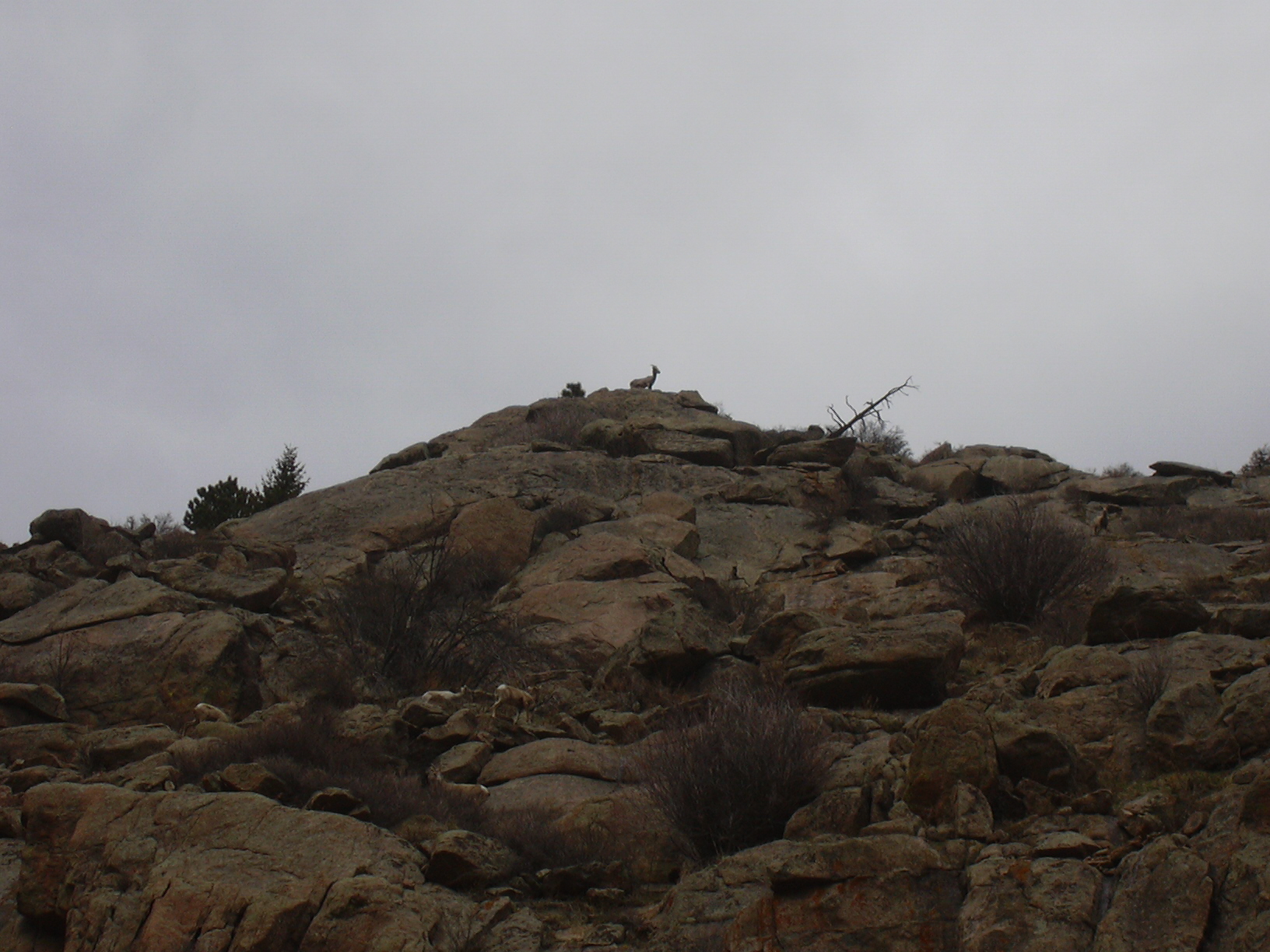
From the low point on North Saint Vrain Creek, we followed the trail, which was snowy in spots, west to the North Sheep Mtn Trail. After the trail crossed over the creek, where it's sandwiched between the creek and the granite wall of North Sheep Mtn, we saw some bighorn sheep above us, grazing on the terraces of the North Sheep Mtn wall.

2013-04-28 Bighorn Sheep on North Sheep Mountain. Larger View
Reaching the gulch, where the North Sheep Mtn Trail leaves North St Vrain Creek, there is a pond, which was dry a few weeks ago, but today was overflowing, with a couple mallards floating in it.
We soon began the steep ascent north, on the North Sheep Mtn Trail, where at the high point we stopped for lunch at an elevation of 8409 feet (time: 12:57, GPS odometer: 4.7 miles), on a nice overlook rock.
From there we took the faint trail to Johnny Park Road, and turned right onto it, which eventually got us back to our parking place. We returned at 15:04 with the GPS odometer at 6.9 miles (an underestimate).
| Place Name | Elev [ft] | Accuracy [ft] | Position (lat,lon) |
|---|---|---|---|
| Parking below Coulson Gulch gate | 7,668 | 16 | 40.25075,-105.41085 |
| Low point on North St Vrain Creek | 6,769 | 26 | 40.21562,-105.41298 |
| High Point on North Sheep Mtn Trail | 8,409 | 20 | 40.23504,-105.44306 |
© 2012-2013 Stefan Hollos and Richard Hollos
Tweet
blog comments powered by Disqus