You can see the tracks for this entire hike.

2014-01-19 East ridge of Coffintop Mtn
Coming from Lyons on Hwy 7, we parked at a wide pulloff on the south side of the road, about a half mile past Deadman Gulch.
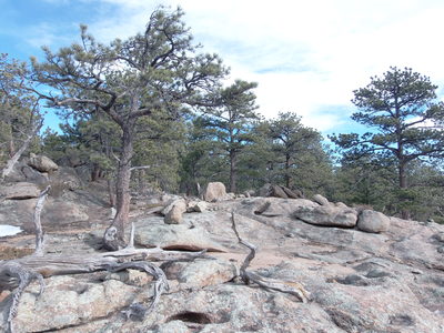
Starting our hike at 10:33, we crossed the highway, and began a steep ascent up a dry sunny slope that's mostly meadow and rock with a few small ponderosa's and junipers. There's a very faint trail formed by climbers who enjoy the rock at the top of the ridge.
Reaching the granite wall near the top of the ridge, we followed its base west and northwest until we reached the ridge top. From there we headed west along Coffintop's east ridge, topping out on a couple knobs before the final steep climb to the summit plateau. The way to the top was mostly snow-free, except for a few shady areas.
We reached the summit at 12:18. It was very windy there but with clear blue sky we could see everything. The east side of Ralph Price Reservoir was frozen. We took a few pics and opened the summit register tube. It had what looked like candy stuffed inside, so we didn't bother to sign it.
From the summit, we headed west, then southwest, and finally southeast toward Coffintop Gulch, eventually reaching an old road that we followed down along Coffintop Gulch. This road had numerous spots along it damaged by the September 2013 flood, which got more numerous as we descended the gulch. Near the end of the gulch the flood damage to the trees and soil was extensive. Where the gulch intersects Hwy 7 there is apparently private property, but the flood had washed out the road, so we were able to exit by the open gate. Otherwise we'd have to reach Hwy 7 by climbing over the ridge to the south.
Reaching Hwy 7, we hiked along the highway toward Lyons about 0.8 miles east and north to reach our parking place, returning at 14:48. The total distance traveled was 5.2 miles, and the altitude difference from lowest to highest was 8030-5757 = 2273 feet.
| Place Name | Elev [ft] | Accuracy [ft] | Position (lat,lon) |
|---|---|---|---|
| Parking off Hwy 7 | 5757 | 26 | 40.19642,-105.32891 |
| Coffintop Mtn summit | 8030 | 20 | 40.19762,-105.35628 |
© 2012-2014 Stefan Hollos and Richard Hollos
Tweet

blog comments powered by Disqus