2013-10-13 Upper Forest Lake
You can see the GPS tracks for this entire hike.
When we arrived at the Moffat Tunnel parking area, we heard a train whistle, then saw the California Zephyr passenger train arrive and enter the tunnel on its way from Chicago to San Francisco.
We started hiking west up the South Boulder Creek Trail at 9:52. Just before Arapaho Creek, we turned right, onto a faint shortcut trail that meets the Forest/Arapaho Lakes Trail further up.
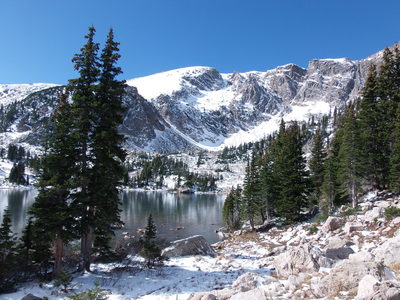
Getting to Lower Forest Lake, we found it already had a layer of ice on it. Upper Forest Lake, surprisingly was not frozen. Stefan pointed out that its larger size was the reason.
From Upper Forest Lake, we left the trail, heading north, eventually passing by a small lake. Around there, we passed above treeline and headed northeast, topping out on a ridge at 12:35 that goes to the divide. Because of the lateness, we decided not to climb the ridge to the divide but descend it to Rollins Pass Road. This we did, with some uncertainty as to whether our way would be blocked by cliffs. There were a few drop-offs that we had to negotiate around during our descent, but we did make it safely to the road.
From Rollins Pass Road we hiked down it to its intersection with the Forest Lakes Trail, which we took for our return. Further down, we didn't take the shortcut to the South Boulder Creek Trail, but just stayed on the main trail.
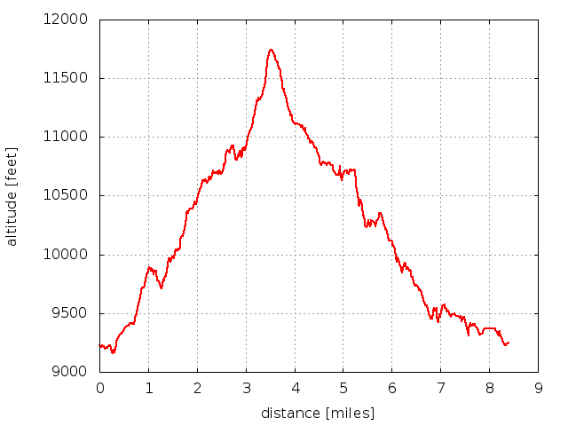
We returned at 15:35, with the GPS data showing a total of 8.4 miles traveled. The elevation difference from lowest (parking) to highest (on the ridge) was about 2,500 feet.

2013-10-13 Elevation profile: Forest Lakes
| Place Name | Elev [ft] | Accuracy [ft] | Position (lat,lon) |
|---|---|---|---|
| Parking at Moffat Tunnel | 9,248 | 26 | 39.90283,-105.64358 |
| High point on ridge | 11,760 | 20 | 39.92767,-105.67364 |
| Rollins Pass Rd - Forest Lakes Trail junction | 11,072 | 23 | 39.92385,-105.66868 |
© 2012-2013 Stefan Hollos and Richard Hollos
Tweet

blog comments powered by Disqus