2015-08-30 Point 11402 and Half Mountain
On this sunday morning in late august, the Fern Lake and Bear Lake parking areas were both full, so we ended up going to Sprague Lake, which happened to have plenty of parking available. We'd never done Half Mountain before, and figured we'd give that a shot with what was left of the day.
Starting our hike at about 10:30, we took the trail that begins on the west side of the Sprague Lake parking area to the Boulder Brook Trail. The Boulder Brook Trail is never crowded, and always delightful as it climbs steeply through forest accompanied by the music of the water. Where the trail ends on the North Longs Peak Trail, we turned right, heading west. After a short distance, the trail crosses over Boulder Brook via a newly constructed bridge - the old bridge having been wiped out by a landslide during the September 2013 flood.
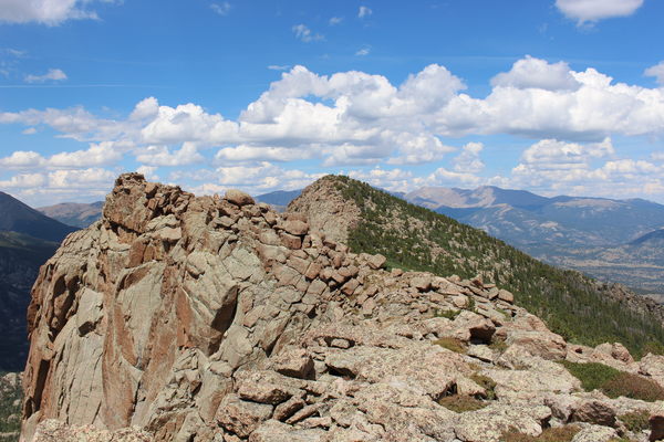
After the bridge, we departed the trail, plunging into the forest and heading southwest to the top of the ridge connecting Half Mountain with Storm Peak. It was slow going, starting with a fairly dense forest, and ending with krummholz. Once on the ridge it was a bit easier - mostly boulder hopping north to the Half Mountain summit. From the ridge, we could look down and see Mills Lake, as well as up Glacier Gorge to Black Lake.

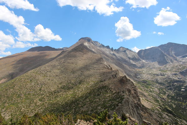
2015-08-30 Storm Peak, Longs Peak and Keyboard of Winds from Half Mtn
We reached the Half Mtn summit at about 13:50. The view is impressive, with a comprehensive view of Glacier Gorge, as well as the ridge connecting Half Mtn with Storm Peak, Longs Peak, and Keyboard of the Winds. There is a summit register tube on Half Mountain, but the register is disintegrated and now consists of tissue paper.
Trying for an easier way down, we descended north of our incoming tracks, but that way turned out to be only slightly easier. It started out as mostly boulder hopping, and then forest of medium density to the North Longs Peak Trail. On the trail, we headed east and returned via our incoming tracks.
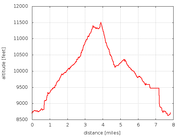
We got back to Sprague Lake at 17:33. The elevation difference from low (parking at 8707 ft) to high (Half Mtn summit at 11509 ft) was 2802 feet. Total distance traveled was about 8 miles. It took 3 hrs, 20 minutes to reach the summit, but the route is unlikely to be one of the better ways up.

2015-08-24 Elevation profile: Half Mountain from Sprague Lake
| Place Name | Elev [ft] | Accuracy [ft] | Position (lat,lon) |
|---|---|---|---|
| Parking at Sprague Lake | 8707 | 20 | 40.32032,-105.60906 |
| Half Mountain summit | 11509 | 20 | 40.28969,-105.63278 |
© 2012-2015 Stefan Hollos and Richard Hollos
Tweet

blog comments powered by Disqus