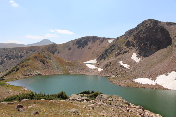
2015-08-24 North Iceberg Lake
West of Tolland, at the east entrance of the Moffat Tunnel, a chipmunk sat on a rock near the railroad tracks, seemingly waiting for a train. Within a few minutes, the California Zephyr appeared. We cannot confirm nor deny that he boarded, but we know our hike started at about 10:27.
We headed up the South Boulder Creek Trail, then took the second right up the Crater Lakes Trail after about 2.2 miles. Before reaching the first Crater Lake, where the trail plateaus at an elevation of about 10500 ft, there is an unofficial trail going to the left which leads the way to Clayton Lake.
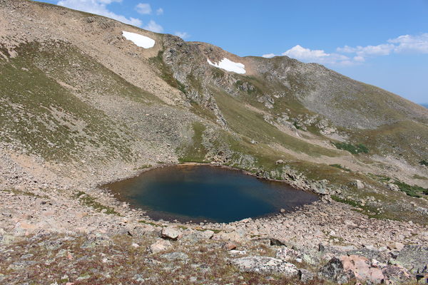
Starting at Clayton Lake, the forest begins to give way to meadow. We continued northwest to the northern Iceberg Lake. From a knob on the northeast side of this lake we took pictures, and was able to see a little of the southern Iceberg Lake, but did not go there. Forming a clockwise loop, we passed a couple ponds, then headed east, making our way back to the Crater Lakes Trail. Most of the way above Clayton Lake was easy tundra travel, with some patches of scree.

2015-08-24 Iceberg Pond
Back at the Crater Lakes Trail, we returned the way we came, reaching the Moffat Tunnel East Portal parking area at 16:53.
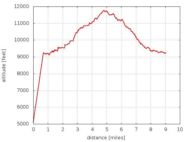
Elevation difference from lowest (parking, 9200 ft) to highest (above Iceberg Lakes, 11700 ft) was about 2500 feet. Distance traveled was about 9 miles.
 Ignore spike at beginning of elevation profile.
© 2012-2015 Stefan Hollos and Richard Hollos
Tweet

blog comments powered by Disqus